

Client : Lebuhraya Pantai Timur 2
Year : 2019
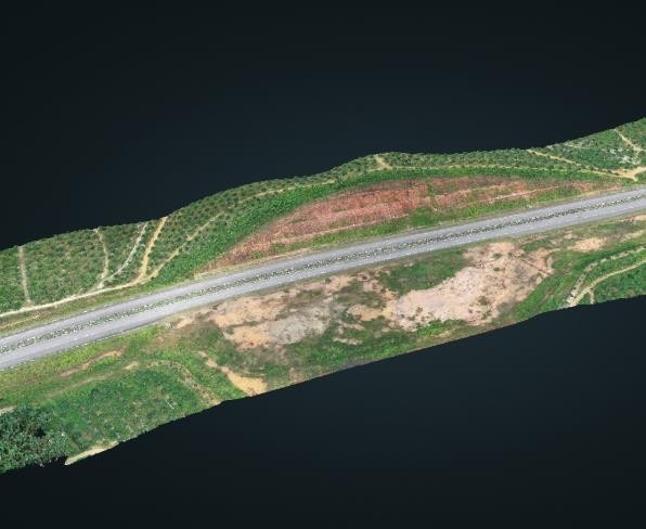
The highway is a dual carriageway that running between Jabor and Kuala Terengganu on the East Coast of Peninsular Malaysia with a total length of 184 kilometers.
The main purpose of this project is for mapping the whole stretch of the highway. The data can be used for improving visualization and making measurements of the length, slope, profile, and coordinates of each point on the ground.
The final output of the project was orthophoto, Digital Surface Model (DSM), and point cloud where Digital Surface Model (DSM) and the point cloud can be view in 3D Web.